
The Panthertown Trace
I believe it must have been me who drug the cold into Appalachia from the West. 700 pounds of ice, so the meteorologists claimed, hung from the power lines between each post, and that is what pulled them down to earth. The rapid temperature drop, which amazingly touched negatives in the high country, caused what may be the ‘25-‘26 Winter’s most googled phrase: “Exploding Trees.”
This is all to say we had quite a bit of cleanup to do, but equally as important, I had a new reason to party in the woods.
I started with the simple question of “what would it take to cover every mile of Panthertown Valley’s trail system in one effort?” Answering this question was just as much a logistical endeavor as it was a physical one, and so, with the joy of a small child getting a new pack of Pokémon cards, I broke out my maps. There are a little over 30 total miles of official USFS trail maintained in the valley, and in a perfect world that would mean landing as close to a 30 mile day as possible, but completing an entire trail system means sidequests and backtracking. All said and done, I was able to produce a series of loops and out-and-backs that amounted to about 42-miles of running. A great deal of the valley is interlaced with hunter’s trails and many, many more are the byproduct of the old school local explorer, Carlton McNeil’s machete. I was pleased with how the route looked and had been growing increasingly enthusiastic to give it a go.
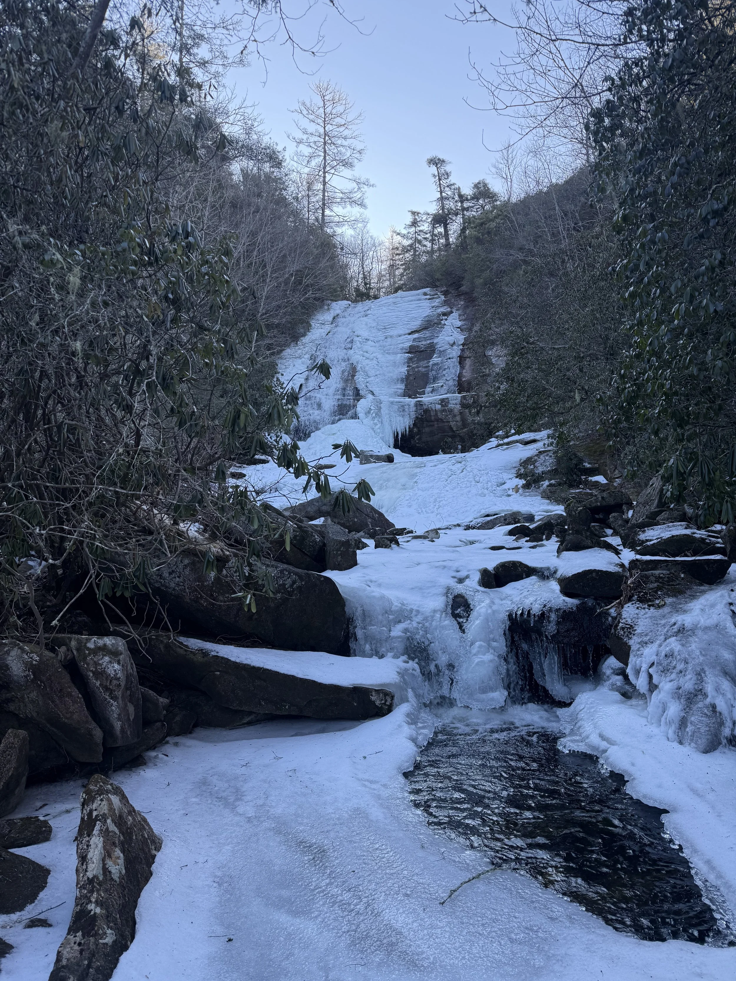
Greenland Creek Falls
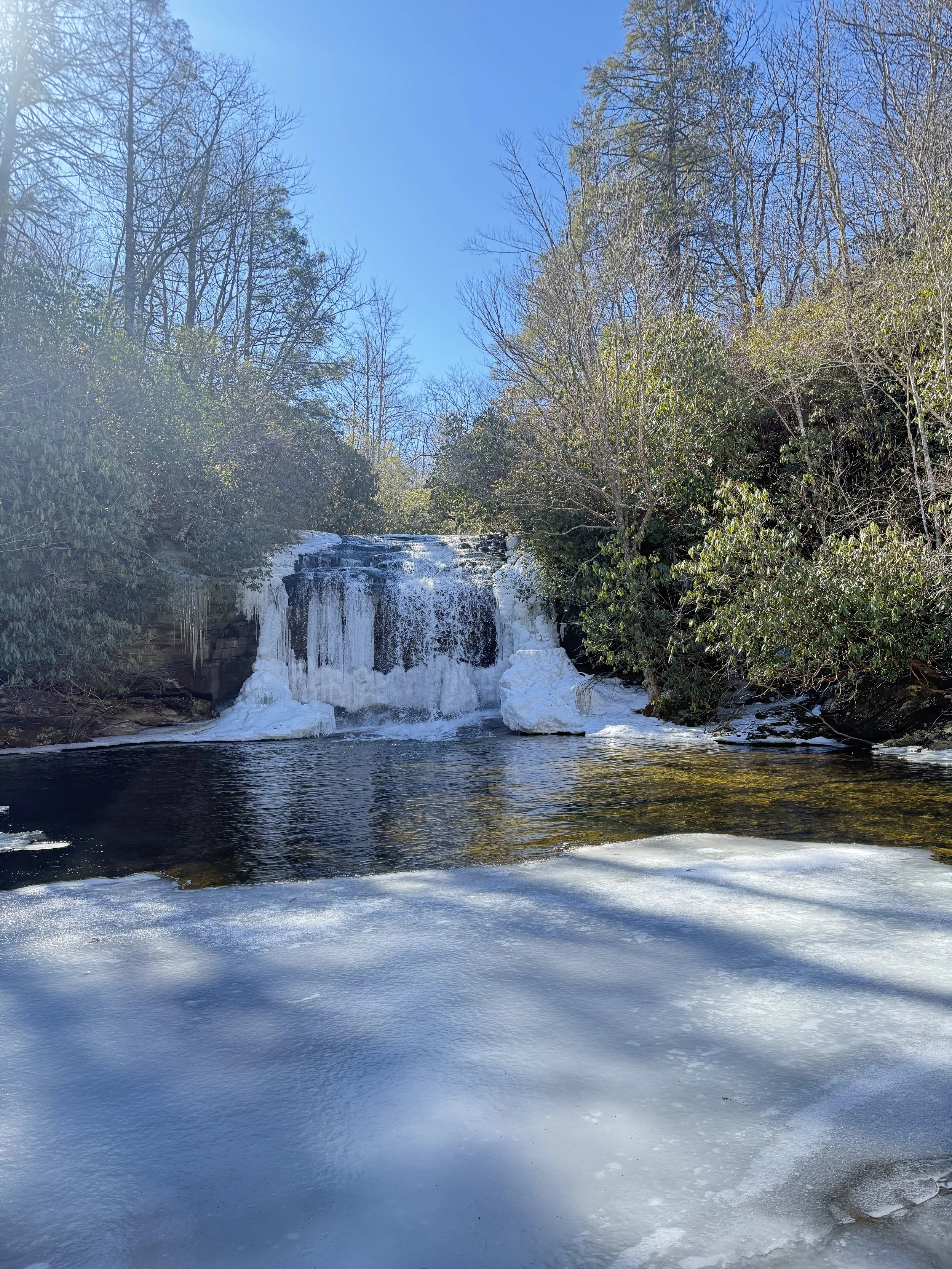
Schoolhouse Falls
So, another day in the mountains begins before the sun arrives to greet the world and before the mercury rises to a temperature appropriate for activities of the living. No matter. I like it better that way.
A wind advisory was placed in effect for the region out of concern that trees would be blown down from their shallow, granite-grasping root clusters. From the hours of 5:00AM to 8:00AM, I found not one single second that allowed me to ignore this fact. While running along the Blackrock Ridge, I was constantly battered by gusts that climbed up both sides of the mountain and shoved me side to side. Snowfall the likes I hadn’t seen since I was a child blanketed the landscape a week prior, and what remained were inches of sheet ice which stood in place of what I remember to be softpack dirt. Every mile and every step was exhilarating, and not for any genuine sense of danger, but because the landscapes of the American so rarely threw together a combination of factors such as these, and I knew I was blessed to be equipped to enjoy the day.
I cruised over Blackrock and down to the Powerline Road intersection. There was a mandatory out-and-back on the Poplar Mountain trail which rolled gradually and was a great way to settle into a rhythm for the day. I had never been on Poplar Mountain, and if it weren’t for the ten more hours of running ahead of me, I may have detoured to climb to the summit from a hunter’s trail I spotted. I came upon two fallen trees before hitting the USFS gate and turning around for my return. I took photos of the debris, noted their location, and moved on wearing a silly grin at the thought of Spring beginning with every fallen timber cut and removed from the system. You see, this wasn’t just an effort for the sake of doing it, I reached out to the Friends of Panthertown conservation outfit and put forth the idea as a supplementary tool to plan upcoming field work days. Friends of Panthertown had been doing a phenomenal job of mitigating erosion areas, installing recreation infrastructure, and creating a more stewardly, well-informed public, and if I could get the entire network’s worth of scouting information all at once, they could devote their energy to the maintenance itself instead of the scouting.
Back to the Powerline Road intersection. I turned left and rolled along the wide trailbed that comprised Turkey Knob, noting an old-growth hemlock tree that had, unfortunately, finally met its end. By the time I completed this trail, shuffled along Rock Bridge Road, and picked my back up (again) to the Powerline Road intersection from Rattlesnake Knob, the sun was finally coming to bestow its greetings.
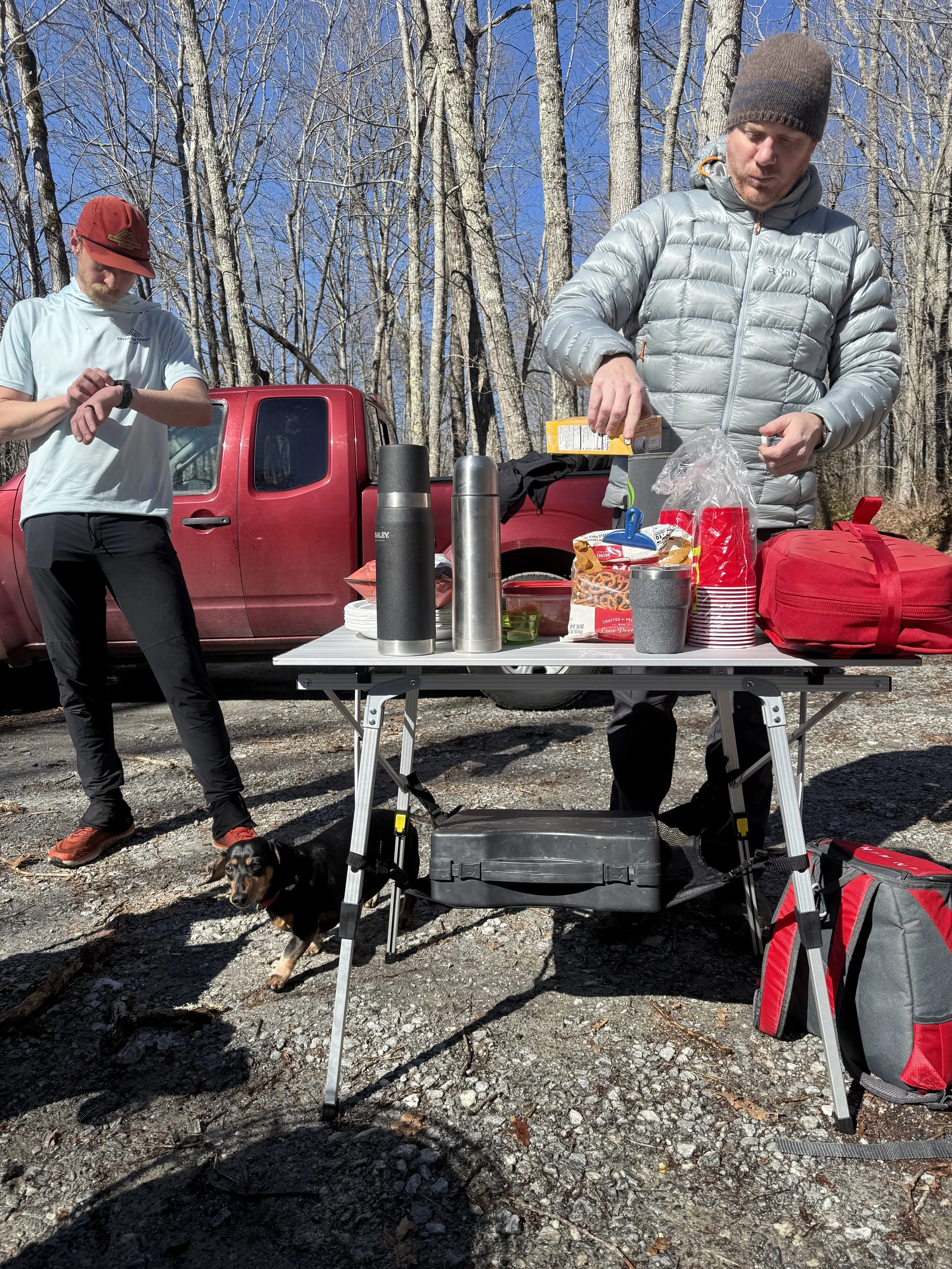
Aid Station Stop w/James and Matthew
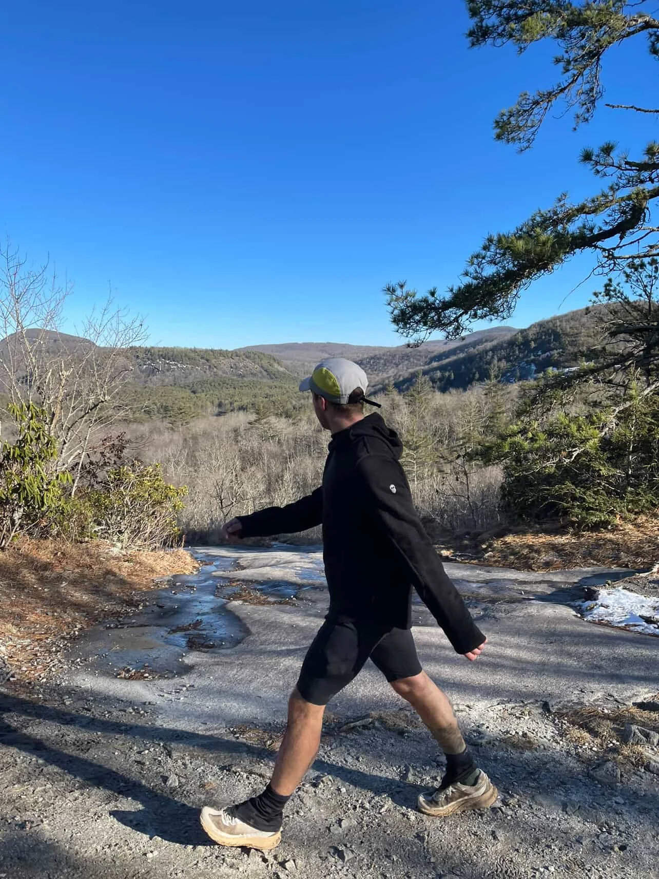
Salt Rock Gap
Much of the rest of the day went as it had begun, only with a few friends along the way. Local guide service owner and operator, James Perkins, joined for a half-marathon’s worth of the steepest and iciest portion of the whole day, and, despite the ankle rolling, the clinging to cliff face rhododendrons, and an unfortunate missed turn hidden behind frozen shrubbery, we made great work out of scampering along frozen waterfalls and granitic domes. We even got to experience Schoolhouse Falls in all its frozen glory, something which I had only done once despite spending most of my life in this region.
We completed our labors by returning James to his truck at the Cold Mountain Trailhead, and waiting for us were all the accoutrements of a trail runner’s aid station. Black coffee, bone broth, snacks and gels, and fat, chicken stew-stuffed burritos waited by a warm fire. I had half a mind to go to sleep right then and there.
After refuelling, I picked my way back down into the valley for the final push. Although I had crossed the Blackrock Ridge, I hadn’t yet picked my way onto the overlook cliffs, and so I barreled straight up the woods, drank in the views with my girlfriend (who also boasts the name “Val”), and scooped up Panthertown’s own trail coordinator, Kara McMullen, for a few hours of sweeping the two trails that run along the length of the bottom of the valley, picked our way up to a community’s private entrance to the trail network, and then brought the whole thing to a close by ascending back up Salt Rock Gap to my van.
All together, it was a silly and slippery 45-mile day that contained a little over a mile-and-a-half of vertical gain across it. I documented six areas in need of servicing, and in the two weeks after putting this project together, two of those areas have already been taken care of by the conservation group.
Following the journey, we took the Pantherown Trace and presented it to the public in the small mountain towns of Dillsboro and Sylva, and Folks. Were. Hyped. I believe in a time when public land ownership and personal political power feels so contentious, we have a growing opportunity to make an outsized impact in the intersection of adventure athletes and conservation. I give the example of The Naturalist 25K and 50K trail race in the neighboring town of Franklin. With a start line consisting of 150 runners, assuming a normal volunteer shift is about five hours long, we would produce —- 750 hours —- of volunteer power off this modest event alone. That comes out to nearly two full-time seasonal trail crew staff members’ worth of impact, and if we expand that impact out into the larger adventure sport community, not just runners, not just climbers, not just kayakers and bikers and naturalists, but to their immediate networks as well, we can take conservation action that truly resembles just how important these wild places are to us.
More soon
Much love, y’all.